Blog

Decrease Operation Costs: Increase your Recycle Ratio

Another term for netback, when looking at Quarterly Reports, is a company’s Recycle Ratio.

Definition

A recycle ratio is quite simple, an oil and gas company puts a lot of money “in the ground” in order to make a profit from their well, this profit vs cost ratio is what we call recycle ratio. Ex. If a company spends 30 dollars/BOE and gets 90 dollars/BOE in return the recycle ratio would be 3:1.

What affects a company’s Recycle Ratio?

Typically services such as the completions, fracture stages used to complete the well, are the highest cost component when it comes to the overall price/well. Most of the other costs are out of the companies hands, for example the cost per BOE they sell at.

Assuming a 20 stage frac price @ 50k per stage = 1 million on completions alone

If the total cost of your well is 4 million, the completion works out to be ¼ the cost of the well.

By reducing the number of stages to 12 instead of 20, 400,000 savings on completions, and still provide the same production outcome this would allow you to increase your recycle ratio from 3:1x to 3.3:1x.

How to use Formation Evaluation data to your benefit:

Formation evaluation is a solution to:

  • Decreasing Frac Stages by better placement

  • Ensuring more consistent well to well production

  • Aiding in booking reserves

  • Providing accurate data for the geologists for future growth opportunities in that same formation or field

Bottom line: Formation evaluation typically costs less than one frack stage alone.

Logging Measurements: Depth

Since there isn't a single reference or measurement system for calculating the depth in sub-surface environments, two engineers talking about a single drilling might give different answers when asked to give a measurement of depth.

The two main depth references used in the "downhole" (i.e. sub-surface) environment are Driller's Depths and Logger's Depths (also called Wireline Logger's Depths). These measurement systems are recorded quite differently and generally Logger's Depths are considered the more accurate of the two:

Driller's Depth Measurement:

Tied to drilling operations i.e. logging while drilling (LWD), measurement while drilling (MWD) and coring.

Driller's Depth is always recorded, and it constitutes the primary depth system, unless it is later superseded by a more accurate measurement such as the depth from an open- or cased-hole wireline log.

Driller's Depth should always have:

  1. a unit of measurement e.g. meter/feet

  2. a datum reference e.g. Kelly Bushing

Importance of accurate depth!

For any logging company Depth is the primary measurement.  Without accurate depth the other readings are of no value because they would no longer matter.

How do logging companies measure depth?

Wireline

Depth wheel(s) measure the length of wireline as it is spooled in/out 

Record depth using timestamps

TimeStamps:

Is a sequence of characters or encoded information identifying when a certain event occurred, usually giving date and time of day, sometimes accurate to a small fraction of a second.

How is the Depth combined with the tool readings?

Wireline

  • Tools are attached to wireline, each measure point has a known distance 

Memory based horizontal logging systems

  • Record depth using timestamps

  • Sync the timestamps and you have the tool readings with depth

  • Pipe tally is the main reference data used to track depth

All drillers should know already exactly what is in the hole being drilled and lengths of each pipe recorded on the tour sheet.  Remember not all pipes are created equal so accurate pipe strapping is important!

Fracturing the Bakken: Save on Hydraulic Horse Power

Companies currently active in the Bakken formation know of its tight dolomitic, old limestone composition. This tight matrix provides many obstacles for the completion and production stages of the companies trying to produce out of this hydrocarbon rich formation.

The hydraulic horsepower used at surface to fracture the Bakken formation and get any production from it is astronomical. High pressures and even higher amounts of money are thrown down the well to ensure fracture networks are made. Cookie cutter fracture methods can quickly cut into your profits per well.

The idea behind fracturing is quite simple, create tensile fractures to give the hydrocarbons a pathway to the borehole. In addition to this it also shears existing fractures. Finding these existing fractures is the key to less horsepower used and cost savings during this expensive stage of your completion.

Two ways that can help you save on horsepower by surveying with a Spectral Gamma Ray tool:

  • Fracture ID – Uranium streak can be used as a permeability indicator

  • Cleanliness Indicator – Isotopes such as Thorium can be used to indicate the cleanliness of the Bakken formation

Using these two surveying methods can guide your completion and help better place the fracture stages in order to use less horse power, aka save money on your completion.

Proof is available to indicate these two money saving solutions in the Bakken using the Spectral Gamma Ray tool.

Determine Porosity in your Horizontal Well (Part 2)

Part 1 of this Blog went over the density tool, how it gets porosity values and what it can be used for. In the case of the Neutron tool, along with providing another porosity value, it is used in conjunction with the Density tool as a gas indicator and lithology identifier.

The Neutron tool measures the hydrogen content of the formation. This hydrogen content is correlated into a formation porosity using the index of water equal to 1.

What does the hydrogen content of a formation give you?

  • When paired with a Density Tool, can aid in the detection of a gas vs. oil bearing formation

  • Calculate porosity for your Water Saturation calculation

  • Since it is casing compensated, provides a porosity for formations behind the casing to surface (typically an ERCB requirement)

How does the Neutron tool work?

With the use of an Americium Beryllium radioactive source, inserted into the tool, the decay process mapped out below shows how neutrons are emitted into the formation.

The steps then begin:

  • The neutrons from the source are emitted at a “fast” energy level, >100 keV, and create interactions with the nucleus’ in the formation, causing them to slow down to a speed that the neutron tool detectors can use

  • The thermal neutrons are then received back at the helium detectors and a ratio of the detectors is used to measure in CPS (counts per second)

    • The ratio is used to compensate the tool for borehole affects and differing source strength

    • The CPS are used to determine the porosity via tool calibration

Gas and Shale Effects of the Neutron Tool

In the event of a gas or a shale formation the Neutron tool provides a falsely low and an expected high reading from these respectively.

1. Gas

In a gassy formation, because the hydrogen content of gas is less than that of water, the Neutron tool will provide porosity readings lower than actual formation porosity. For example, in a clastic rock such as sandstone, with the curves plotted on a sandstone matrix, the Neutron and Density curve will actually cross when in a gassy formation.

Note: This crossing may also occur if your plotted matrix is limestone and you are actually in a clastic formation.

2.Shale

Due to the amounts of bound water in shales, a higher percentage of the neutrons from the source are slowed down, and in turn captured by the detector. From this, a higher count rate is detected, which correlates to a higher porosity reading. This increase in porosity is not seen by the Density tool, providing you with a pronounced spread between the two curves when in a shale.

Calibration and why it is necessary:

As mentioned in Part 1 of this blog, calibrations are very important to ensure the conversion from CPS to electron density is correct. In the case of the Neutron tool, the calibration is done to generate a detector ratio / porosity relationship.

What 2 things affect the quality of the density data?

  • Mud system – Elements such as chlorine in the mud system (aka salty mud), will in fact capture the emitted neutrons before they reach the detectors, causing an error in the tools response

  • Logging Speed – Being a statistical tool, like the Density, the quality will be affected by logging speeds

Neutron Tool Differences

Since the LWT Neutron Tool is safely located within the drill string, porosity can be corrected for the casing/drill pipe size, using industry standard charts. There are no differences between Cordax's tool vs any typical Neutron tool on the market.

Determine Porosity in your Horizontal Well (Part 1)

A density tool, typically ran in open-hole formation evaluation, is used to calculate the total porosity of a given formation. The measurement is derived from the electron density of the formation. From the electron density the bulk density is calculated, which is then used to calculate primary porosity.

What is the primary porosity measurement typically used for?

  • When paired with a Neutron tool, can aid in the detection of a gas vs. oil bearing formation

  • Calculate porosity for your Water Saturation calculation

  • Provide a borehole caliper measurement

How does the Density tool work?

With the use of a Cesium 137 radioactive source, inserted into the tool, the decay process mapped out below shows how Gamma Rays are emitted into the formation.

The steps then begin:

  1. The gamma rays from the Cesium sources are absorbed through interaction with the formation

  2. Gamma rays received back at the scintillation detectors are measured in CPS (counts per second)

  3. The CPS are used to determine the electron density via tool calibration

The electron density is then used to calculate bulk density:

The bulk density is then used to calculate primary porosity:

The medium and long spaced detectors are used in conjunction with each other; this allows the tool to compensate for borehole effects such as mudcake.

Calibration and why it is necessary:

As mentioned above, the calibration is very important to ensure the conversion from CPS to electron density is correct. To do this a spine is created by using two materials of totally different densities, such as concrete and aluminum. From this calibration a density correction is uses if borehole conditions are affecting the density reading.

Note:

Negative density correction should only be seen if the mud is denser than the formation you are reading. An example of this would be coal or really gassy formation. If this is not the case, typically the tool calibration is off and can be re-calibrated and corrected after the logging has been completed.

What 2 things affect the quality of the density data?

  • Mud system – Certain additives to the muds such as KCL, Barite and Bentonite will either emit or absorb external gamma rays

  • Logging Speed – Being a statistical tool the quality will be affected by logging speeds

Density Tool Differences

Most open-hole density tools require borehole contact with a pad and use a directional source. The reading can be greatly affected by the orientation of the tool in the borehole and in the horizontal section of a well a dual density usually has to be run to obtain this, which increases the cost of the service.

Cordax's LWT’s density tool, being safely located inside of drill pipe, is omnidirectional. This allows the tool to read 360 degrees around the borehole collecting an average formation density. Also with a third detector the tool is able to calculate a pseudo caliper and density correction similar to that of any conventional borehole contact tool.

Pembina Cardium: Re-Launch of Western Canada’s Largest Oil Pool

After 50+ years of Pembina Cardium production, how can the remaining oil still be produced economically, before the reservoir is depleted?

History

The Pembina Cardium pool was discovered in 1953, with the success of the Socony-Seaboard Pembina #1 4-16-48-8W5 well.

Initially, all wells were vertical and targeted the Cardium ‘B?’ sandstone.

In the late 80’s and 90’s, Directional Drilling was applied to thicken up the interval.

In 2009, horizontal drilling with Multi-Stage Hydraulic Fracturing was borrowed from the Bakken operations, and typically applied to the Cardium ‘A’, a previously unproductive low permeability oil sand.

Description – Geologically Speaking

The Cardium is a reservoir rock with stacked successions of silty mudstone, siltstones, and fine to very fine grained sandstones; coarsening upwards to a conglomerate. The sands are informally designated as the Cardium ‘A’ and ‘B’ sandstones, to differentiate the producing zones. The source rock for the Cardium is considered to be the Second White Speckled Shale, although some feel that the First White Speckled Shale and Fish Scales may also have been the source rocks. The Cardium is further sealed above, by inter-bedded mudstones of the Colorado Shale.

The formation top is identified on logs by a distinct resistivity shoulder, after a continuous mudstone interval. The base of the Cardium can also be identified by a resistivity double shoulder, resembling the Russian letter ‘Z’, and often referred to as the ‘Russian Marker’.

Insight – What Happening Now

Experience, new technologies, and experimentation, have come together to re-launch the Pembina Cardium play.  The overlooked Cardium ‘A’ tight oil sand of the Cardium formation, has now become a target. The less congested ‘halo’ areas of the field, are being drilled with great success by multiple Operators. Current estimates show the Cardium play lasting for another 50 years, with as little as 17% of the total reserves currently depleted.  It is estimated that with current technologies, this may increase to 40% in the next five years.

With the current price of oil becoming unstable, a couple of things have become apparent.

You need to reduce your AFE costs.

Here are a few suggestions:

  • Automated Directional Drilling (Rotary Steerable)

  • Optimized Drill Bits

  • Collaborate with your Peers

The first two may sound expensive, or even trivial; but are not when you look at the big picture. Rotary Steerable drilling systems (RSS), coupled with an Optimized drill bit for that particular system, will pay for themselves by increasing ROP’s (rate of penetration), thus reducing drilling hours and costs. RSS drilling systems will produce a smoother hole, with little to no doglegs or troughs. Smoother holes aid in the placement of multi-stage hydraulic fracturing equipment.

Collaborate with your peers, regarding best drilling practices. What RSS drilling system and bits are they using? What Mud System are they using, and are they adding anything to their mud system that has increased ROP, or enabled a longer leg? Have they been using any special handling equipment on the rig that has reduced time? Have they got different strategies regarding drilling of these wells, which has reduced time or added efficiencies?

Secondly, Increase Production?

Longer Horizontal Legs

  • Multi Legs

  • Increased Frac Stages

  • Careful Selection of Proppant Fluids

  • Open Hole Logs

  • Microseismic

  • Decreased Well Spacing

Now, let us look at the production; which typically varies from well to well. There are a lot of variables to evaluate when drilling these wells, however, some stand out as being more economical to evaluate and understand than others.

Longer horizontal legs have been achieved by the use of Mechanical devices such as the Agitator or Exciter tools. A less expensive option is the use friction reducing glass beads, which are recovered after the drilling operation. Once the rig is set-up and drilling, why not spend the extra time required to drill these longer full target lateral legs, if you stay within your land. While you are at it, why not drill a second leg? The cost may rise by 25-35%, but is still more economical than two separate wells. Second to these, is to increase the number of frac stages for completion of the well. Numerous papers have highlighted the increased production rates where frac stage spacing’s have been shortened. No one to date has reported frac interference, due to a shorter spacing. What has been reported, is an increase in Productivity proportional to the number of fracs placed.

The Hydraulic Fracturing proppant utilized, and the oil production observed, was the old decision making process. Today, Microseismic has scientifically answered a lot of these questions. One Operator reports that Slickwater fracs are the answer, while another reports that by the use of Microseismic, they see why a Foamed Water frac was superior.

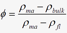
The use of Open Hole Logs plus Microseismic , will allow the Operator to see at what depths the frac got away, and what to look for in future Well Logs. A combination of Logs and Core data, can be used for Petrophysical Analysis in this Unconventional reservoir. Combinations of Log, Core and Seismic datasets will answer a lot of questions, and yield a better understanding going forward.

Last but not least, is the decrease in well spacing. As of October 6-2011, the well density controls for lower quality reservoirs has been amended by the ERCB (Energy Resources Conservation Board), which applies to the current Cardium play. This has been a long time coming, and slow to be adopted. Utilizing decreased spacing, opens another door to increased production from your land.

The Cardium has colossal hydrocarbon storage capacity, which has allowed, and will allow, economic development in the years to come, due to the advancements in oilfield technology.

Spectral Gamma Ray – Bakken and Duvernay Mapping

The Bakken and Duvernay have proven to be the most sought after formations in North America today. With many companies currently getting high returns from these formations due to precise placement of fracturing intervals, it has demonstrated how mapping out the horizontal section of your well can be a huge advantage. With both formations being high in Uranium, a typical Gamma Ray curve is not sufficient when trying to correctly identify the source formation in comparison to the over and under lying formations.

How does the SGR (Spectral Gamma Ray) Work?

The SGR tool uses an analyzer to split the natural gamma radiation emitted from the formation into energy levels, which are then broken up into the following three isotopes:

  • Potassium – 1.46 MeV

  • Uranium – 1.76 MeV

  • Thorium – 2.62 MeV

These three isotopes from the SGR tool, if summed together using API units, are equal to the conventional Gamma Ray tool output value.

Formations such as the Bakken and Duvernay have high Uranium salt deposits, that falsely identifies it as clay shale, rather than it’s Dolomite/shale composition. Many times during the drilling operation the wells toe up or toe down veers into the adjacent formation, the MWD Gamma Ray, and conventional Gamma Ray tool would not see a great variance in values between the clay shales and Dolomite formation due to this highly radioactive Uranium.

4 Things the SGR is used for:

With the increased vertical resolution of the SGR tool in comparison to a Gamma Ray tool and the ability to quantify incident Gamma Ray energies into Thorium, Potassium and Uranium, the SGR can aid in the interpretation of:

  • Depositional Environments

  • Clay Typing

  • Identifying Fractures

  • Differentiating radioactive carbonates from shales

What 2 things affect the quality of the SGR data?

  • Mud system – Certain additives to the muds such as KCL, Barite and Bentonite will either emit or absorb external gamma rays

  • Logging Speed – The SGR tool is statistical, therefore the slow it is logged the better the quality will be

With the high uranium content formations being evaluated, the requirement to provide the most out of every well drilled, it has been proven how affective the SGR tool works.

Opportunity Abounds in Unconventional Reservoir Source Rocks

With the conversion to unconventional resource development, drilling and evaluating a horizontal shale (gas/oil) well, has become a very expensive proposition; requiring a better understanding of the Rock your production will come from.

When you read reports on a given play, you may see statements much like this: "Organic rich Type II Kerogen shale, with up to 7.2% TOC – total organic carbon (averaging 3.8% TOC). The rock is a mature source rock (in the condensate rich gas zone), with an average of %Ro = 1.11."

What does this mean, and how does it correlate in evaluating your play? Let’s have a look at the following, before proceeding any further.

If you are in a hydrocarbon productive basin, there will be a mature Source Rock someplace in the section. The terms Source Rock, Kerogen, and TOC (total organic carbon), are often referred to in the study of gas shales. To truly understand unconventional resource development {gas shales}, we need to consider what a shale is, what constitutes its makeup, and what distinguishes a gas/oil shale.

Shales are:

  • Fine grained sedimentary rock compiled of clay minerals, and microscopic fragments of other minerals such as quartz, dolomite, and calcite and varying amounts of dispersed organic matter.

  • Shales can appear as laminations, parallel to the bedding.

Gas/Oil Shales are distinguished by:

  • Gas shale’s contain adsorbed gas, and the adsorbed gas is proportional to the organic content of the shale.

  • Free gas is contained in the porosity, proportional to the effective porosity and gas saturation in the pores.

  • Higher radioactivity readings, due to uranium enrichment.

  • Clays that hold the bound water, while the Kerogen holds the absorbed gas.

Organic rich shales have been Source Rocks, providing other rock with oil and gas over time. These were formed as part of the depositional process of sedimentary rocks, and organic matter. Of prime interest in North America, are the marine - lipid and protein rich organic matter, contained within Type II Kerogen source rocks. A good example of this is the prolific Duvernay shale, which provided hydrocarbon to the Leduc and Nisku formations.

Kerogen is defined as the fraction of large chemical aggregates in sedimentary organic matter that is insoluble in solvent. Kerogen is classified by looking at the source material, using Pyrolysis, Vitrinite Reflectance (%Ro), or other lab procedures. Kerogen is the main source of TOC, and is radioactive due to Uranium salts.

Kerogen Type and Source:

  • Type I-algae

  • Type II-primarily plankton, minor algae.

  • Type III-higher plants

Kerogen Amount %, Type of Deposit:

  • Type I-II, ~ 1%, oil source rock

  • Type I-II, <50%, oil shale

  • Type III, >50%, coal

TOC (Total Organic Carbon) is the source of the hydrocarbons, and also takes up space. A geological model would show the conventional porosity holding the free gas and irreducible water, the clay holding the clay bound water, and Kerogen holding the adsorbed gas. TOC’s are measured in weight%.

Thermal Maturity is defined as the degree of heating of a source rock in the process of transforming Kerogen into hydrocarbon, and measured by Pyrolysis or Vitrinite reflectance.

With the above knowledge, we can better complete our homework when evaluating the play. By the use of: Logs, Cores, Geological Mud Logs, Gas data, and cutting descriptions, we can develop the ‘Big Picture’. These will be necessary for:

  • Understanding the geology within the region

  • Determining porosity (ø) and TOC (offsetting logs, Spectral Gamma Ray)

  • Geochemistry (cuttings and cores in the area)

  • Rock Mechanics (Sonic and Caliper logs)

These Unconventional plays will be expensive depending on depth and local. However, they can be within reach of a restrained budget, if the following criterion is met:

  • Initially, partner up; this may be the best initial move towards development

  • Drill a single vertical, ‘proof of concept well’

  • Determine the presence of mobile hydrocarbons, hydrocarbons in place, and level of production after the fracturing process

Unconventional Resource plays are risky; however, with accurate knowledge and understanding of the rock to be produced, the upside may be a prolific discovery well.

Logging Horizontal Wells – The Game is Changing

Canada and the United States are leaders in best practices of designing and innovating horizontal well technology. Horizontal wells now account for a large portion of all wells drilled in both countries. One best practice often neglected by some oil/gas companies is logging horizontal wells.

New Approach to Horizontal Wells

The long period when horizontal wells were considered a ‘last resort’ is underlined by the under-development of logging systems and interpretation for horizontal wells. The methods available have lagged behind the advanced interpretative techniques developed for vertical wells, but this situation is changing. Research and development programs are at the forefront to yield new approaches to log analysis in horizontal wells.

New logging methods that have emerged as horizontal wells become standard practice are:

  • Logging While Tripping (LWT)

  • Pipe Conveyed Logging (PCL)

  • Shuttle/Garage System

  • Logging While Drilling (LWD)

Each system produces similar results in that logging data is the final product, though there is some variance on the delivery methods.

Benefits of logging the horizontal sections:

  • Recognition of changing reservoir quality such as porosity or fluid content

  • Measurements of resistivity with minimum invasion

  • Revealing faults early enough to react to potential problems

  • Detection of fluid boundaries

  • Replacement of pilot holes

  • Frack and completion optimization

  • Mapping of sweet spots

Still Not Convinced?

All of the above mentioned has the potential to make or break a well. While logging waivers may seem like the easy way out and may potentially save minor costs on the overall AFE, the overall benefits from the potential missed information could affect the final oil/gas production of that well. The lack of data could also affect future well placements and missed opportunities on lucrative land sales.

So when it comes to your conventional thinking on logging horizontal wells, turn your ideas sideways and think horizontal!

Can You Save $80k by Optimizing Your Next Horizontal Well?

When in the context of a horizontal well and the investments made throughout the start to finishing process, saving any amount of rig time will instantly decrease the bottom line costs. As a VP of Exploration, horizontal drilling is a huge investment with many risks, so why not look for getting the most bang for your buck during the operation.

Most horizontal drilling operations, during the timeline of spud to completion tend to:

  • Cause your company nuisances with the rig time they consume

  • Are attached with what seems to be an inflated costs to get to the production stage

A few points to consider

If the option to get a logging waiver from the Energy Resources Conservation Board (ERCB) arises, most companies might think this is a huge incentive and will end up saving them money, but

  • A geologist can take the guess work out of future growth opportunities for your next horizontal well

  • A geologist can verify if he has gotten actual cuttings from the drilling operation and not caving from formations higher up

  • Fracture stages can be minimized

  • Fracturing in an unrecognized fault may cause a term called “watering out your hole”, which will reduce the production amount of hydrocarbons


For the fracking process alone, each stage is a costly process at $80,000 a pop. With placing a dollar figure on only one aspect of the completions operation we can see how these costly processes can be a waste if that area of the formation turned out to be toed in or out of the required fracture formation. In addition to fracking into a fault, which was described earlier as “watering out your hole”, this could very well be the answer to why some wells are producing more or less hydrocarbons even though they are drilling through the same formation.

How to use formation evaluation data to your benefit:

Formation evaluation may very well end up saving you bottom line costs in the long run by:

  • Optimizing the completion stages of your well

  • Providing accurate data for the geologists for future growth opportunities in that same formation or field

Bottom line: Formation evaluation typically costs less than one frack stage alone; see for yourself with a formation evaluation quote.